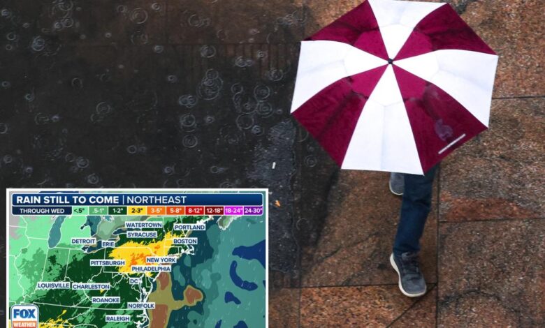
Northeast faces another soggy weekend as stalled storm threatens rain for days

The weekend forecast in the Northeast is looking all too familiar, with more rain and thunderstorms expected across the region. This marks the sixth out of the past seven weekends that precipitation is in the forecast. Despite the slow advancement of the front, much of Saturday could remain relatively dry along the I-95 corridor as temperatures soar into the 80s, making it feel more like summer. However, storms are likely to break out across the interior Northeast and mid-Atlantic Saturday afternoon before moving toward the coast in the evening.
Any storms that develop in this unstable environment have the potential to produce damaging winds and large hail, prompting a level 1 out of 5 risk on NOAA’s Severe Weather Outlook scale for Saturday. An upgrade to the risk is possible given the dynamics at play, according to the FOX Forecast Center.
FOX Weather Meteorologist Melissa Torres stated, “So, Saturday, we do have the risk of some thunderstorms from Boston all the way down into the northern part of Florida.” This includes areas such as Philadelphia, Boston, and Washington, D.C.
Looking ahead to Sunday, the forecast becomes more uncertain as a stalled low-pressure center is expected to break off from the main flow of the jet stream and linger over the Ohio Valley for several days. This setup typically results in long-duration rain events as the counterclockwise flow around the low interacts with clockwise flow around a high-pressure center, creating a funnel of atmospheric moisture that remains stationary for days.
While it’s too early to pinpoint the exact location of the heaviest rain, a widespread area of 2 inches or more of rain is expected from the mid-Atlantic into the Northeast, with some areas potentially seeing 3-5 inches by the storm’s end. Multiple rounds of showers with embedded downpours can be expected from Sunday through at least Tuesday as the stubborn low slowly dissipates.
The FOX Forecast Center warns that heavier rain late Sunday into Monday and again on Tuesday could lead to instances of flash flooding. NOAA’s Weather Prediction Center has issued a multiday flood outlook from Saturday through Monday for cities like Charleston, West Virginia; Washington, D.C.; New York City; and Hartford, Connecticut.
Despite the challenges posed by the weather, the rain will be beneficial for areas experiencing drought conditions. However, residents in the affected areas should remain vigilant and prepared for potential flooding.


