

NASA Satellite Images Reveal a Skull-Like Glacier Landscape on Antarctica’s Vega Island
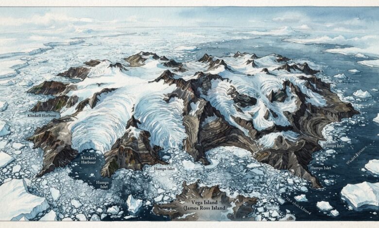
SCIENCE & WORLD — October 31, 2026. Just in time for Halloween, NASA’s Earth Observatory has spotlighted an Antarctic landscape that resembles a grinning skull. The feature, published October 30, 2026, examines Vega Island in the Weddell Sea, where a combination of ice, exposed rock and glacial debris creates the uncanny outline.
A face formed by geology, not a mystery
In the NASA Earth Observatory report, a rocky nunatak resembles an eye socket, a lateral moraine forms a mouth and Devil’s Bay Glacier suggests a jawline. These are natural formations. The appearance is an example of people recognizing familiar shapes in landscapes, not evidence of an artificial structure.
Two satellite images, two different seasons
The NASA feature compares images acquired by Landsat 9’s Operational Land Imager on March 22, 2025, and October 10, 2026. The earlier view shows more snow cover; the later image shows larger areas of darker, exposed ice. The comparison also spans different points in the Southern Hemisphere’s seasonal cycle, so a single image pair should not be mistaken for a complete climate trend.
Glaciologist Mauri Pelto, cited by NASA, said above-average winter temperatures in 2026, particularly in June, were partly responsible for the exposed ice. Wind and sublimation also reduced snow cover. Darker ice absorbs more sunlight than fresh snow, potentially increasing melt as Antarctic spring and summer advance.
Why scientists monitor Vega Island
Satellite observations help researchers track glacier boundaries, exposed rock, snow conditions and changes over time in remote places that are difficult to visit. NASA notes that earlier Landsat work helped map 29 glaciers on Vega Island and that researchers have monitored the mass of Devil’s Bay Glacier since the 1998–99 austral summer.
What it means
The skull-shaped view makes an attention-grabbing seasonal image, but the scientific value is the long record of observations behind it. NASA’s report connects the striking appearance with questions about snowfall, surface temperature and glacier change. Readers can view the actual Landsat images on the agency’s site; this article’s featured image is an original editorial illustration rather than a satellite photograph.
Source: NASA Earth Observatory: Vega Island Frozen in Fright, October 30, 2026.